Mpumalanga Information Bureau
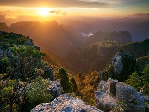 The name means east or literally “the place where the sun rise” in Swazi, Xhosa, and Zulu. Mpumalanga lies in eastern South Africa, north of KwaZulu-Natal and bordering Swaziland and Mozambique. It constitutes 6.5% of South Africa’s land area. In the north it borders on Limpopo, to the west Gauteng, to the southwest the Free State and to the south KwaZulu-Natal. The capital is Nelspruit (recently renamed to Mbombela).
Prior to 1994, Mpumalanga was part of Transvaal Province. The Drakensberg Escarpment divides Mpumalanga into a westerly half consisting mainly of high – altitude grassland called the Highveld and an eastern half situated in low altitude subtropical Lowveld / Bushveld, mostly savanna habitat. The southern half of the Kruger National Park is situated in the latter region.
Cities & Towns:
|
 Weather Forecast:
![]()